
PHOTO
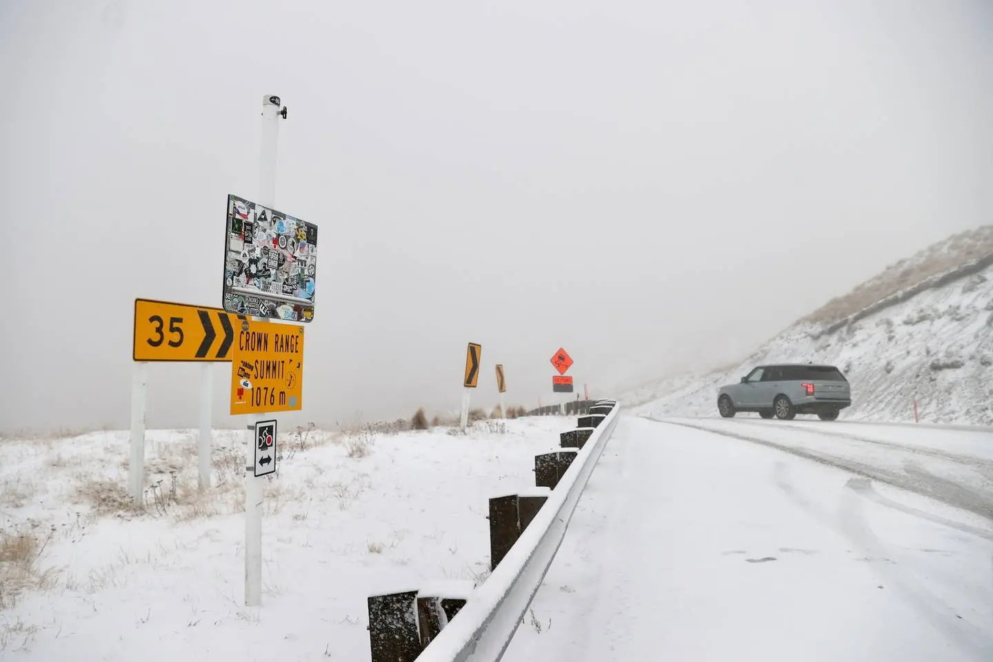
Weather is causing disruptions in the South this morning, with flights affected, and roads and schools closed as a polar blast sweeps through.
All Air New Zealand flights in and out of Invercargill Airport have been cancelled today, and several services in and out of Dunedin Airport have been affected.
- Check flights at Dunedin Airport here
An Air New Zealand spokeswoman said flights were being disrupted across the country because of "terrible weather".
A Dunedin Airport spokeswoman said the airport was experiencing high winds, and the affected flights had been scheduled for smaller ATR72 propeller aircraft.
MetService this morning updated its severe weather forecast to include Dunedin and Central Otago in a heavy snow watch which took in much of the southern area.
It warned of snow to 100 metres, possibly heavy at times. Snow accumulations may reach warning criteria above 200 to 300 metres.
Widespread snow has already been falling in Southland today, there have been falls in Queenstown, Balclutha, Naseby and Ranfurly, and there have been reports of flurries in some of Dunedin's hill suburbs.
State Highway 87 (Outram-Kyeburn) is closed owing to snow. The Milford Road (SH94) was closed for a time this morning but has reopened. However, it is expected to close again tonight. The Crown Range Road between Queenstown and Wanaka was also closed and is now open again, but chains must be carried.
A snow warning is in place for Dunedin's Northern Motorway (SH1) from 3pm today.
All other highways were open around 10.15am, but snow and strong wind warnings were in place on several roads.
Some schools in Southland have closed for the day, including Northern Southland College, Lumsden School, Balfour Primary School and Mossburn Primary School.
MetService forecaster Gerard Bellam last night said an active cold front would "ooze up" the South Island from the Antarctic, bringing bitterly cold winds which could reach 100kmh at times.
Additionally, snow is forecast to lower to about 100m and accumulations could reach warning criteria above 200m in parts of the southern region.
"I think this will be Otago and Southland’s first significant winter outbreak of the year."
Niwa's forecasting and media principal scientist Chris Brandolino this morning said the country was being hit by “a big punch of cold air” coming off the ice from deep in the polar region.
"The South Island’s going to cop the worst of it," Brandolino told The AM Show.
“The windchills are going to be brutally, brutally cold."
He said that by sunset today, windchills for the lower third of the South Island could be down to -15 degrees Celsius.
MetService's Bellam said the weather would cause hazardous driving conditions and stress to livestock around the region.
"I’m sure the farmers have taken heed with the heavy snow watch and the road snow warnings, to move stock to lower grounds."
Large south-to-southwest waves were also expected to spread northwards over coastal areas of New Zealand today and tomorrow.
"You can get waves smashing up on to sea walls and the rocks, so people around the coast should be mindful that it’s not a safe time to be fishing off the rocks."
The waves might also cause damage to roads and communities typically affected by swells from these directions, he said.
MetService yesterday said that in Dunedin and Oamaru this morning, frequent showers, some heavy, would turn to snow down to 200m, and thunderstorms and hail were possible about Dunedin after noon.
Southwesterlies, gale in exposed places, could gust to 100kmh in both places.
Conditions in the Clutha area would be similar, except snow would fall to 100m and a heavy snow watch is in place.
In Queenstown, Wanaka and Alexandra, frequent rain showers were expected to turn to snow showers this morning and would be accompanied by cold, gusty southwesterlies.
In Invercargill, showers would be sleety, but in Gore and Tapanui, there would be frequent snow showers, and heavy snow watches are in place.
Squally thunderstorms and hail were also possible in these places, and there would be strong and gusty southwesterlies.

A heavy snow watch is also in place for Fiordland (south of George Sound), where accumulations may approach warning amounts above 200m in 6-hour periods.
Mr Bellam said road snowfall warnings were in place for the Dunedin to Waitati Highway (3pm today to 7am tomorrow), where up to 4cm of snow was expected to settle on the road above 200m and lesser amounts at lower levels.
Milford Road can expect 15cm-20cm of snow to settle above 500m between 3am and 7pm today; the Crown Range Rd can expect up to 6cm to settle on the road between 3am today and 2am tomorrow; Lindis Pass can expect up to 8cm above 500m between 6am and 11pm today; and the Haast Pass is expected to receive up to 3cm of snow on the road near the summit between 5am and 2pm today.
"People are advised to keep up to date with the latest Watches and Warnings in case any changes are made, or further areas are added," he said.
The cold southwest flow would continue over New Zealand tomorrow and Wednesday, gradually easing later in the day on Wednesday, as a ridge of high pressure established itself over the country for Thursday and Friday.