
PHOTO
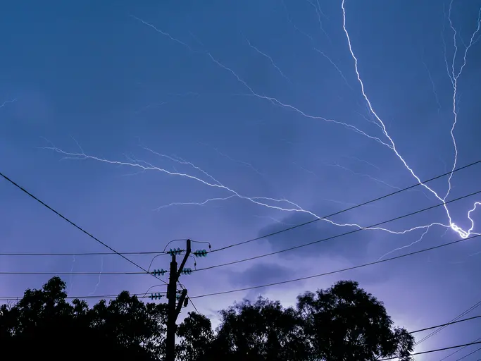
While Christchurch enjoyed a balmy 23 deg C on Wednesday, other parts of the South Island were lashed by heavy rain and thousands of lightning strikes as a severe weather front passed over.
Fiordland and Milford Sound bore the brunt of the weather, while six addresses had power cuts after a property was struck by lightning in Queenstown
A Fire and Emergency New Zealand spokesman said crews responded to a property in Spence Rd, Lower Shotover, just before 7.45am after it was hit by a lightning strike.
There was no fire but emergency services waited at the scene until power authority, Aurora Energy, arrived.
Six Aurora Energy customers were experiencing a power outage on Spence Rd.
A crew was investigating and the estimated time for the power to be restored was 2.30pm.
MetService head of weather news Heather Keats told RNZ's Midday Report it was a stormy day for parts of the country.
"At the moment the region that's bearing the brunt of it has been definitely over Fiordland, Milford Sound.
"They've just had quite a relentless night of thunderstorms. We're talking about almost 4000 lightning strikes in the last 12 hours.
"A significant amount of rain with over 100mm in six hours up to 11am - that's the Milford Sound."
She said the actual rain band was just starting to move north.
The heavy rain and gale-force winds lashing much of the country has prompted MetService to issue a raft of orange warnings and watches.
These include severe gale northwesterlies gusting 130 kilometres per hour in exposed places in the Canterbury High Country.
Orange heavy rain warnings have been issued for the Tararua, Buller and Westland ranges, Canterbury and Otago headwaters, and parts of Fiordland.
Up to 180 millimetres was forecast for the Westland ranges on top of what has already fallen.
There was a minimal chance the warnings would be upgraded, but MetService encouraged people to prepare for possible surface flooding, slips and difficult driving conditions.
Orange strong wind warnings for severe gales have been issued for Wellington, Wairarapa and the Tararua District from Wednesday afternoon.
The gales could make driving difficult, especially for high-sided vehicles and motorcycles, and might damage to trees, powerlines, and unsecured structures.
MetService has also issued yellow strong wind watches for Marlborough, Christchurch, Canterbury Plains, Queenstown Lakes, Central and North Otago and Dunedin.
Snow may also affect some of the higher South Island roads for a time on Thursday.
Balmy 23 deg C in Christchurch
Meanwhile, as hundreds of Dunedin residents grappled without power and parts of the country were being inundated with heavy rain and gale-force winds, Christchurch is having a mini-spring heatwave.
Keats said the severe weather front has pushed the heat up in the southern city to a balmy 23 degrees.
She said the rain, thunderstorms and gusty winds were consistent with changeable spring weather.
"There is some good news amongst all of this because it's driving up the heat so at the moment central Christchurch has 23 degrees. That's what they're sitting on - it is very warm in the east.
"But then they have to expect to plummet back to wintery type temperatures - on Friday their high is only 12."
Warning for motorists
The New Zealand Transport Agency (NZTA) said flooding has closed State Highway 6 between Haast and Makarora.
NZTA said motorists should avoid the area or delay their travel.
The Transport Agency is also warning Wellington region and Kāpiti Coast motorists to be extra careful on Wednesday afternoon and overnight with severe gales and large swells expected.
Strong winds gusting up to 120 kilometres an hour are slated for the capital, and are expected to impact residents from 1pm Wednesday until 6am Thursday.
Truck, vans, campervans and motorcyclists should take care in exposed places such as Remutaka Hill, Wainui Saddle, and Transmission Gully.
Meanwhile, a large swell warning is in place on the Kāpiti Coast for six hours from 3am on Thursday.
It could affect the stretch of State Highway 59 between Pukerua Bay and Paekākariki.
MetService meteorologist Lewis Ferris told Nine to Noon a lot of the weather was focused in the South Island.
"Parts of Fiordland and Milford Sound have already seen about 130mm of rain. Twelve hours ago they saw 100mm of rain in six hours."
Ferris said that rain was moving its way up the West Coast.
"Plenty of strong north-westerly winds ahead of it. Already seen some big gusts around Canterbury High Country - even parts of Canterbury plains as well."
Ferris said the already blustery wind in Wellington would increase throughout Wednesday.
He said there didn't look to be any flood risks at present but there had been plenty of thunderstorms around Fiordland.
Ferris said there would be "embedded very heavy rain" within the thunderstorms and anyone driving should "take it easy".
"If you do hear that thunder it is best to head indoors and wait for until it passes.
"Tomorrow it looks like that front moves over the North Island."
However, he said the weather wouldn't be as severe by Thursday.
"It's a busy weather day but this is a pretty springy system so we shouldn't be too surprised to be seeing this weather around the country.
Ferris said the country would get a brief respite and then a very similar system for the weekend.
Next week was also looking a bit unsettled, he said but MetService expected the weather to settle by October.
-By Mark John, ODT, with RNZ