PHOTO
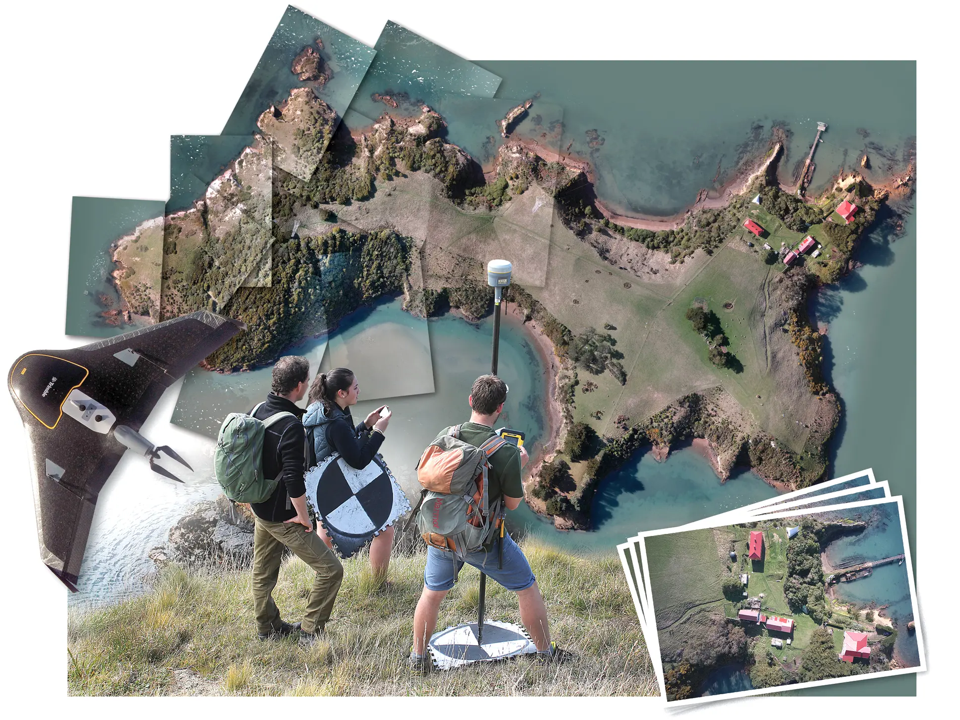
A drone flies almost silently and barely visible, high above Quarantine Island in Otago Harbour. As it flies swiftly, back and forth along a predetermined course, a powerful camera mounted on the fixed-wing drone’s undercarriage takes many dozens of photographs, each capable of spying and capturing, in high definition, objects as small as a wind-fallen chick lying on the island’s grassy paddocks.
This is the culmination of the inaugural project undertaken by the first generation of New Zealand degree-level surveying students to be taught the use of unmanned aerial vehicles (UAVs), commonly known as drones.
"It was great," Dr Pascal Sirguey, who is a senior lecturer at the University of Otago School of Surveying, says.
"Drones are now being used increasingly in many aspects of science, surveying being one of them.
"But we are the only ones training surveyors in drone technology, at the moment."
The survey, conducted last year, took only 20 minutes to complete. During that time, the 2.5kg drone, which was launched by catapult, flew 120m above sea level, at a speed of 80kmh, taking more than 500 overlapping photographs of the 750m-long, often steeply edged, island that until 1925 nurtured, and sometimes buried, the ill who reached Otago by ship.
Preparing for those 20 minutes, however, took several weeks. As well as developing safety procedures and mapping protocols, the class had to become confident in the use of the drone.
The images from the flight were then digitally stitched together to create a seamless aerial photograph of the island at an unprecedented level of clarity. For much of Dunedin, previous aerial surveying has had a resolution of 40cm. That means someone viewing the Dunedin City Council’s online aerial photographs of the city could zoom in and be able to view, in focus, ground objects 40cm wide. The surveyors’ Quarantine Island image has a 5cm resolution.
Helping make the survey happen were the Department of Conservation and the Quarantine Island/Kamau Taurua Community.
"The survey will provide valuable detailed information that will add to the understanding of the ecology and heritage features on the island," island community secretary Kristen Bracey says.
Closer view
To view an interactive 3-D model of Quarantine Island, using images collected by the surveyors’ drone but presented at a lower resolution, visit online at http://quarantineisland.org.nz/ and scroll to the bottom of the home page.