PHOTO
Residents in parts of the upper North Island are being warned to clear drains and gutters and avoid low-lying areas due to heavy rain.
MetService has issued orange heavy rain warnings for eastern Northland south of Kawakawa until midnight, eastern Auckland north of Whangaparāoa until 3pm, and Great Barrier Island until 2pm.
The forecaster says streams and rivers may rise rapidly, with surface flooding, slips, and difficult driving conditions all possible.
Up to 150mm is forecast to fall in parts of Northland before midnight, while Auckland gets drenched by up to 120mm of rain in the 16 hours to 3pm, with thunderstorms possible.
Slips are being reported north of Auckland and in Coromandel, after heavy rain drenched the regions.
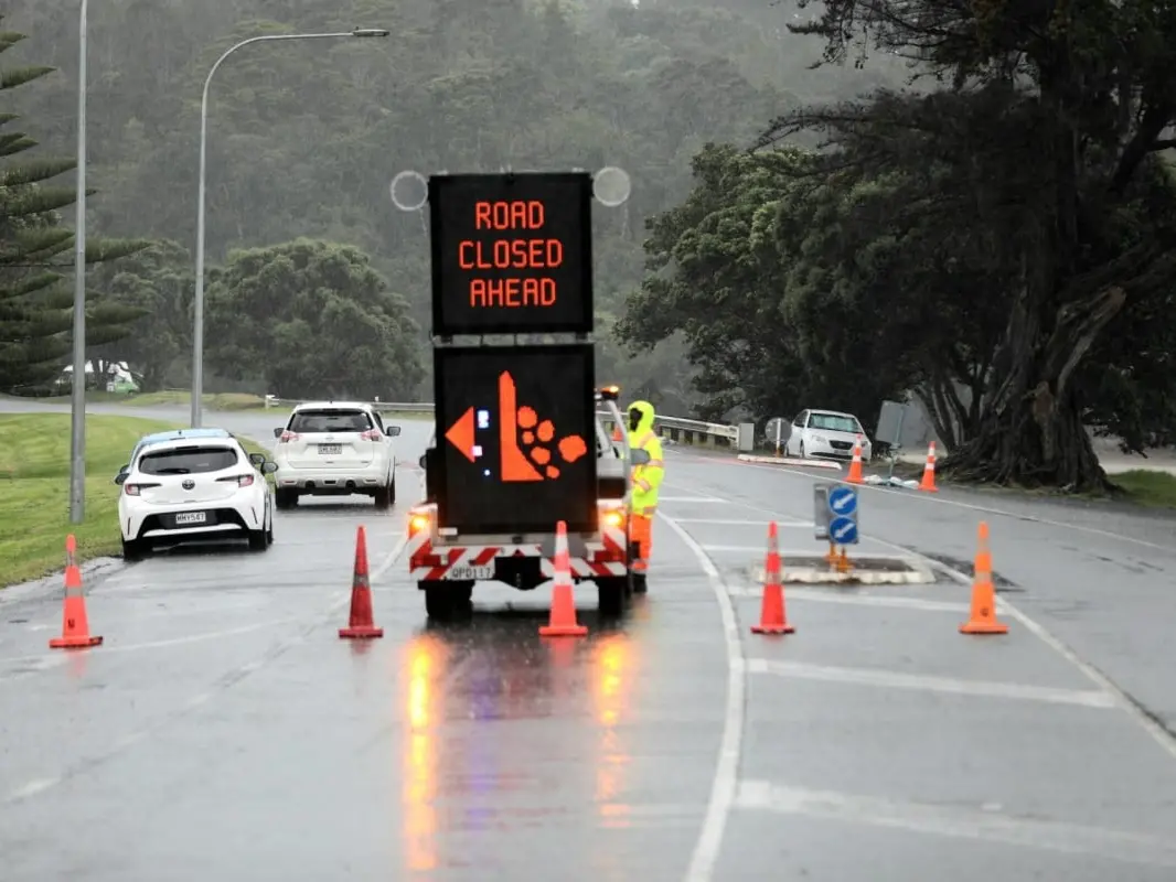
The Hibiscus Coast at Waiwera, north of Auckland, has been closed after a large slip.
A police spokesperson said the slip was reported just after 6.30am near Weranui Road and six properties have been affected.
Eighteen homes had been evacuated, the fire service said.
The NZ Transport Agency said the non-toll road was closed from Hatfields Beach to the Puhoi interchange.
It said Weranui Rd would only be accessible to residents until further notice.
There are no reports of injuries but motorists are advised to avoid the area.
Near the top of Coromandel Peninsula, Port Jackson Road is closed because of two slips and a downed tree.
Rising waters in the same place are also making the road impassable and crews are having to wait for it to go down before they can respond.
A heavy rain watch is also in force north of Papakura, while parts of Coromandel and Northland are under a similar rain watch.
After a week of thunderstorms, intense downpours and winds, MetService is forecasting settled conditions for most of the country for Anzac weekend, with Dawn Services expected to be largely dry, but cold - especially inland.
"Waiouru is set to be one of the coldest spots, with temperatures around 1C at daybreak," MetService meteorologist John Law said.
While nights will remain chilly, plenty of sunshine will help lift daytime temperatures, particularly across the eastern South Island.
Canterbury and Otago are expected to be the warmest parts of the country this weekend, with Dunedin forecast to reach around 22°C on Saturday, about five degrees above average for this time of year.
Fine weather should continue into Monday, with only isolated showers in the south and west.
"There will be a few showers pushing into Southland and parts of the West Coast, but for many, especially those recently affected by severe weather, it will be a welcome break," Law said.
It comes after downpours that drove widespread flash flooding across Wellington early on Monday morning, with costs of damage expected to be in the millions of dollars.
On Thursday Wellington Mayor Andrew Little called for donations from locals who could afford to kick in cash or things like furniture, saying some families have lost everything.
This story was first published on rnz.co.nz |